Birding the north end of Lake Havasu

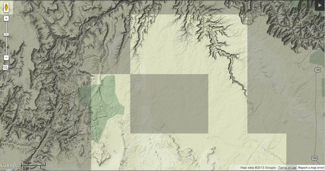
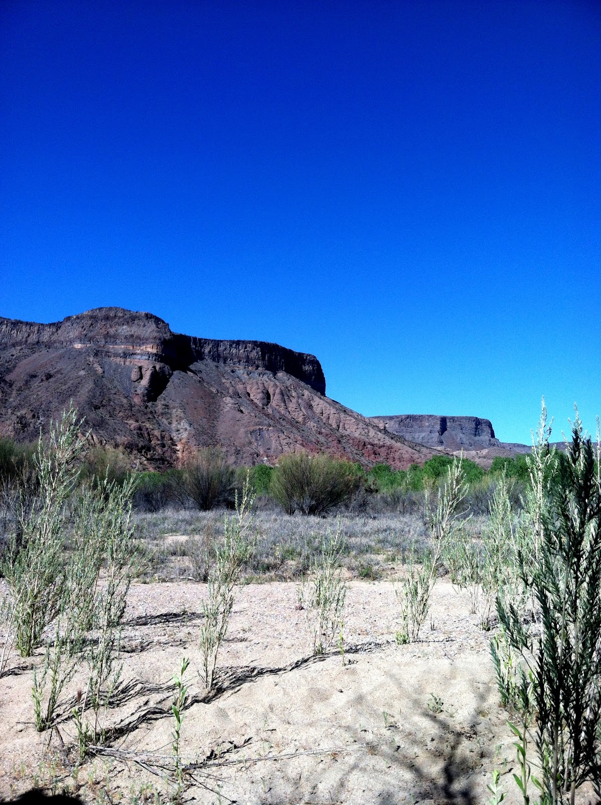
I’ve written many times about Lake Havasu’s north end, particularly Cape Havasu. I’ve written about many of the rarities that have been seen there, and about the many reasons why I enjoy birding there. Now it’s probably about time I describe how to bird the north end and its various vantage points. While Cape Havasu is clearly my favorite, each one is worth checking and can offer views of different sheltered coves, and has a different mix of lakeside vegetation attracting passerines. Be sure to check out this Google Map to view all the locations.

North End Lake Havasu

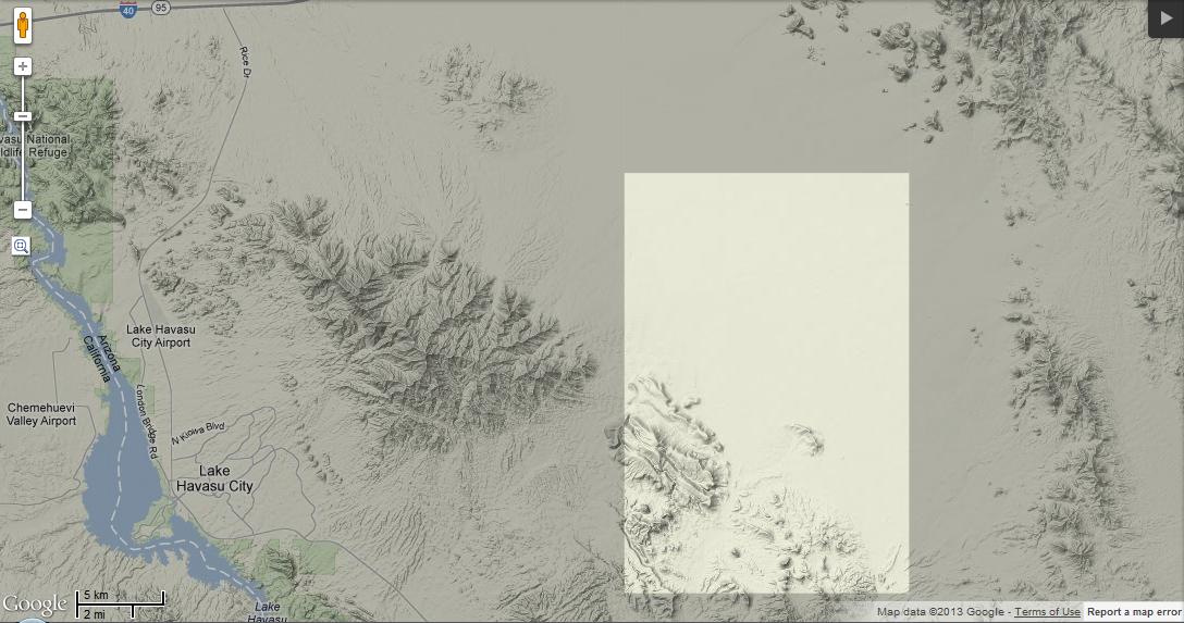
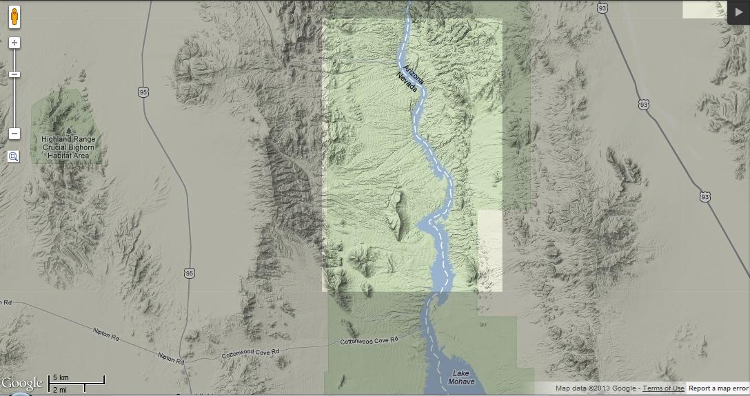
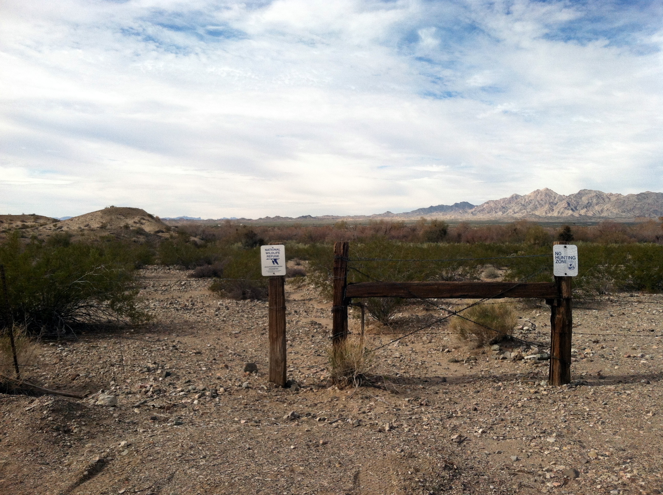
Google map showing Cape Havasu (the northernmost spit in the center of the screen) and Mesquite Bay North (both spits on the south end of the map).

Starting from the south. From the highway, turn west on Industrial Avenue. It comes to a 4-way stop at London Bridge Rd. Go straight to visit Lake Havasu State Park, or turn right (north) to explore the north end.

The first viewpoint reached doesn’t have a name, and access is a bit iffy. London Bridge Rd. crosses a wash just before it goes up a hill and through a small residential area (look for a 25 mph speed limit). At the wash, there is a wide pullout on the west side–not necessarily meant for parking, and a bit sketchy. From here, a trail follows a series of hills out to the lake, and provides a nice view of the sand bar that forms when lake levels are low. This sand bar can be very attractive to gulls and shorebirds.

Continuing north, a sign marks a dirt road leading to Mesquite Bay South. A few trails lead off from the parking area, around and up the hills. Dense arrowweed here can be very attractive to migrants, and this isn’t as popular among the public as the nearby Mesquite Bay North.

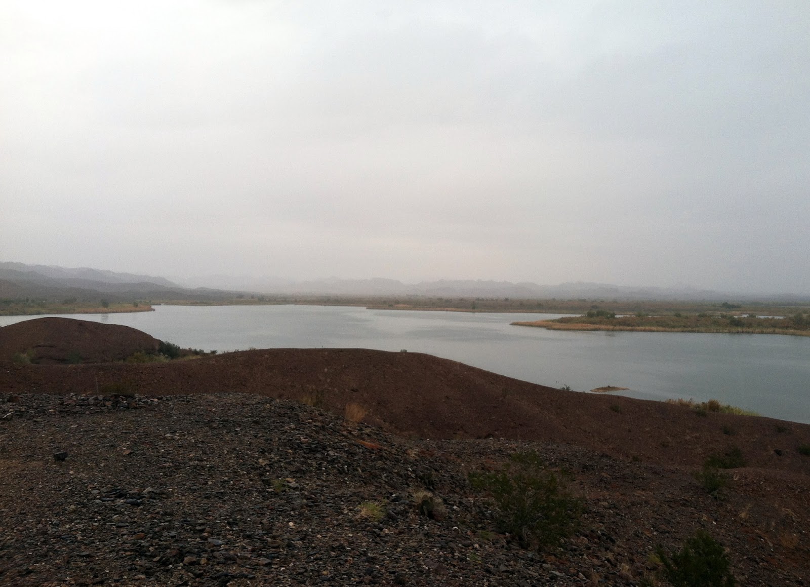
The next viewpoint heading north is Mesquite Bay North, also well-marked, and this one with a paved parking lot right off London Bridge Rd. Outhouses are a bonus, sort of, but personally I’m only willing to deal with the abundant wildlife of that particular outhouse in an emergency. My skin crawls just thinking about it. Anyway, this is a nice place with paved trails, interpretive signs, a fishing dock, etc. It can be full of people at times. Dirt trails around the two points here provide access to some nice riparian vegetation, and the south point provides a very good viewpoint of the lake. This is the deeper part of the lake’s north end, which can be great for loons, grebes, diving ducks, and the like.

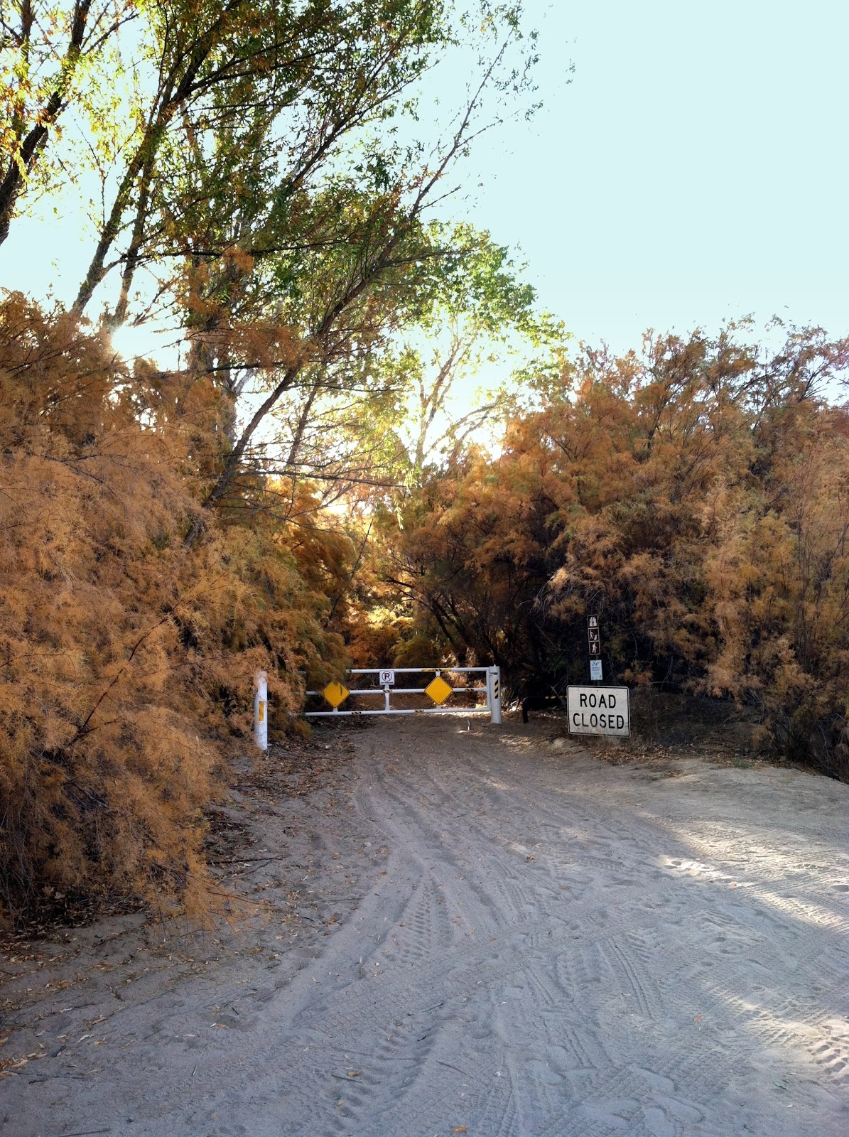
Continuing north on London Bridge Rd., the road goes past a bunch of trees (willows) on the left, then goes up and over a hill. On the left side just north of the hill, a large palo verde marks a wide pullout. This is the parking for Cape Havasu. You’ll know you’re in the right place when you see two National Wildlife Refuge signs on a barbed wire fence: one saying NO HUNTING ZONE, the other saying “Authorized Access Only”. Not to worry, you’re okay as long as you don’t bring in a dirt bike. There is a fairly narrow gap in the fence here (it’s a bit of a squeeze with a coat, camera, scope, etc.), and watch out for the single barbed wire strand just off the ground!

Signs at Cape Havasu

When visiting Cape Havasu, look for these signs to mark the entrance.

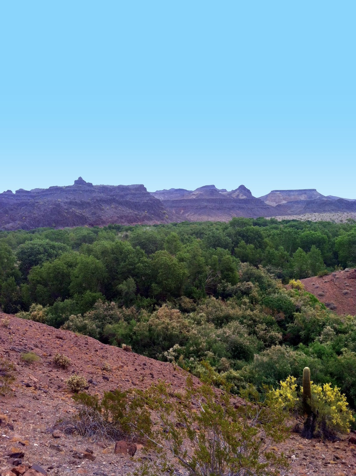
From here it’s easy to follow the trail up to the top of the hills. I like this viewpoint in particular because you can see the deeper water around Mesquite Bay as well as the shallow water around the marshes at the very north end. The narrow riparian vegetation around the hill funnels migrants, making this an amazing place to watch the birds go by.

Long-tailed Jaeger

LCRV Rarity Photos

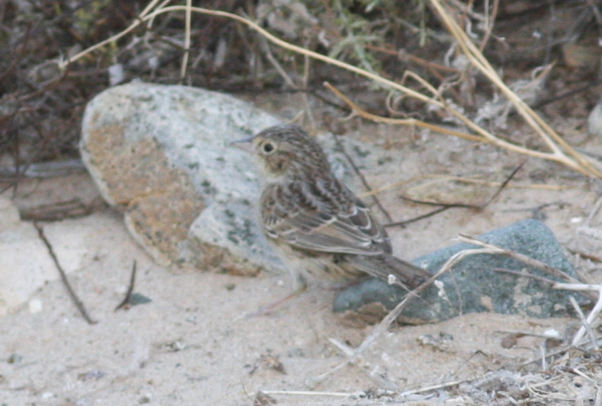
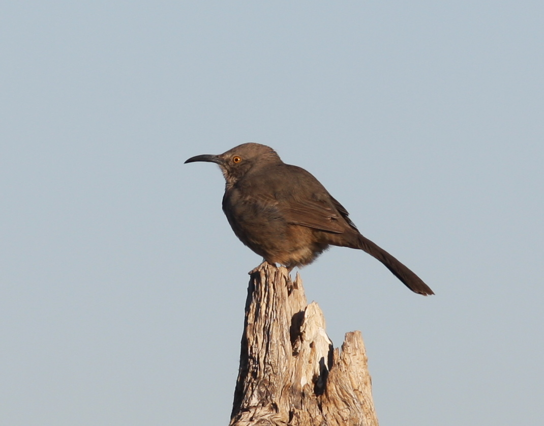
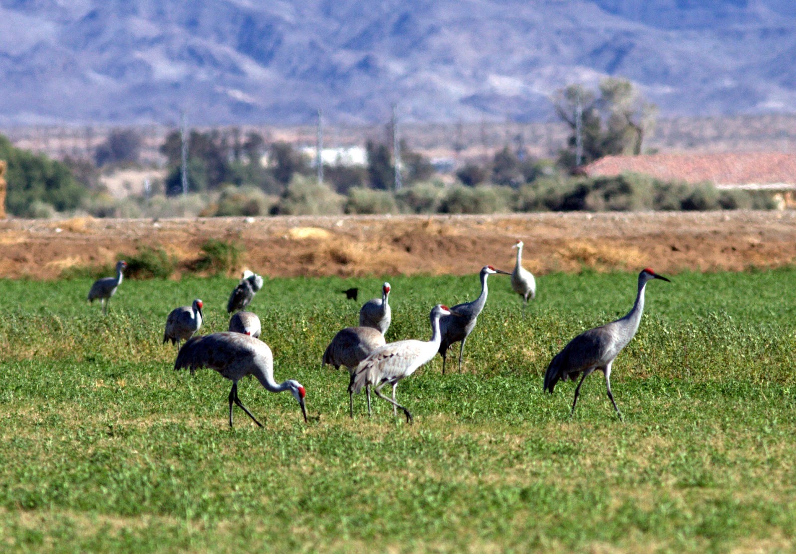
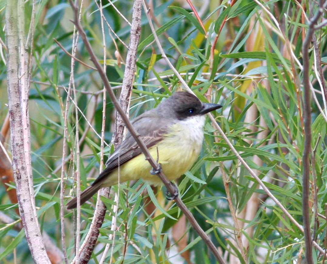
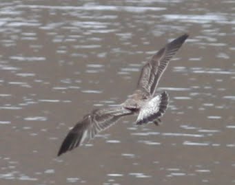
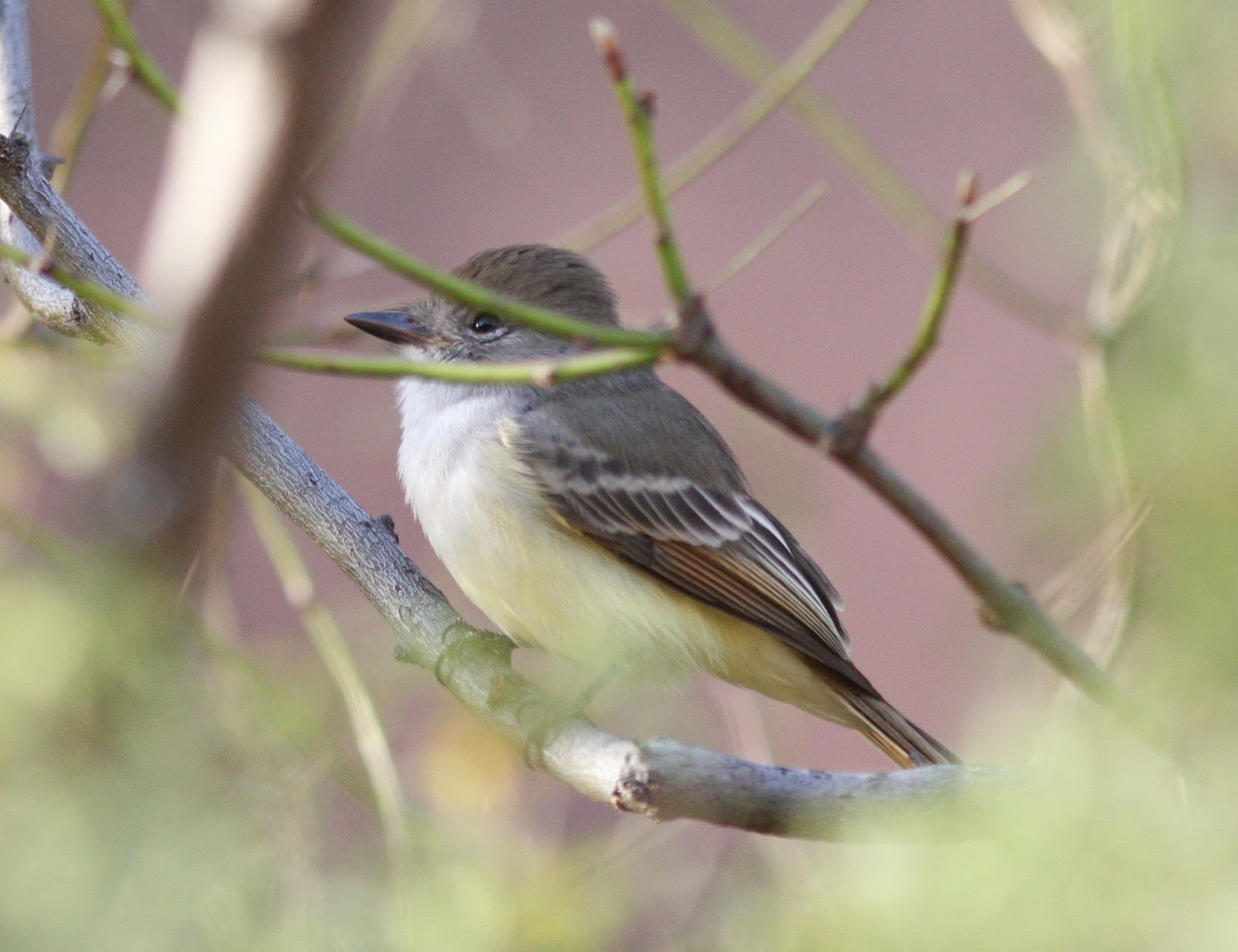
From Long-tailed Jaegers to Cassin’s Sparrows, you never know what could turn up at Cape Havasu! Jaeger photo by David Vander Pluym; sparrow photo by Lauren Harter.

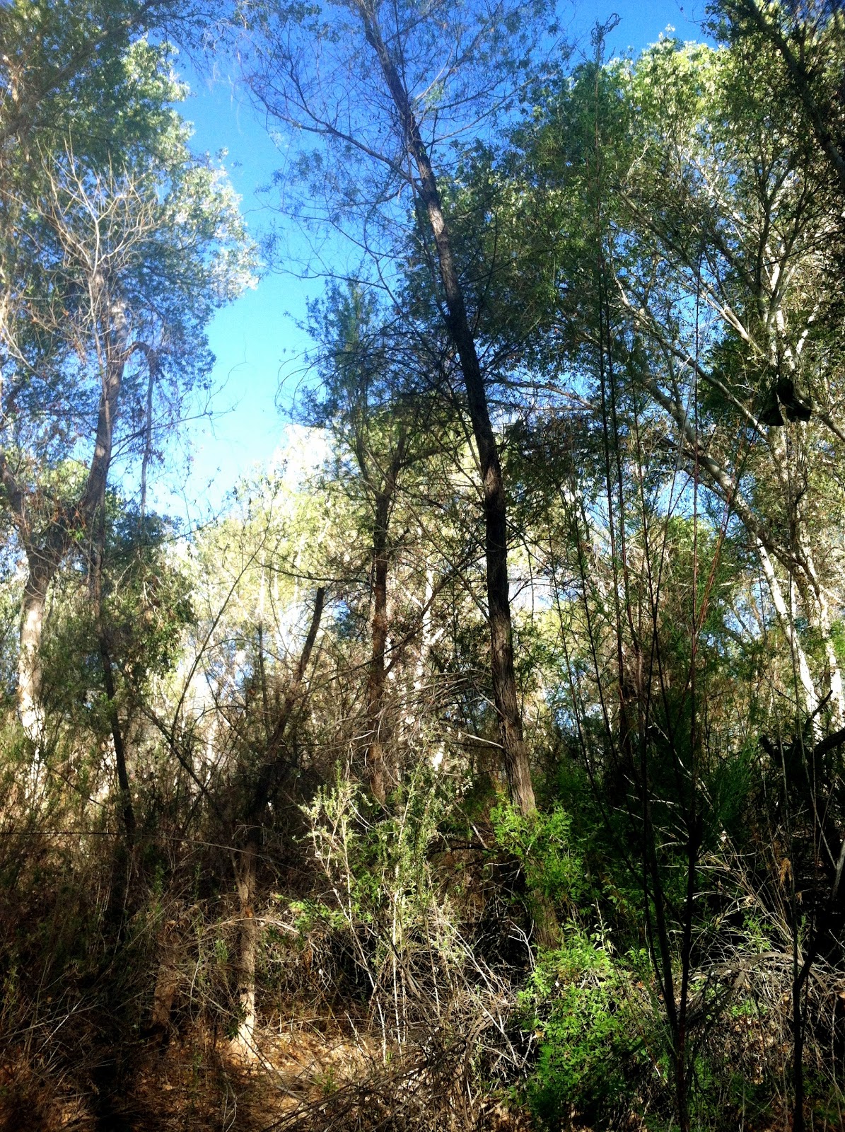
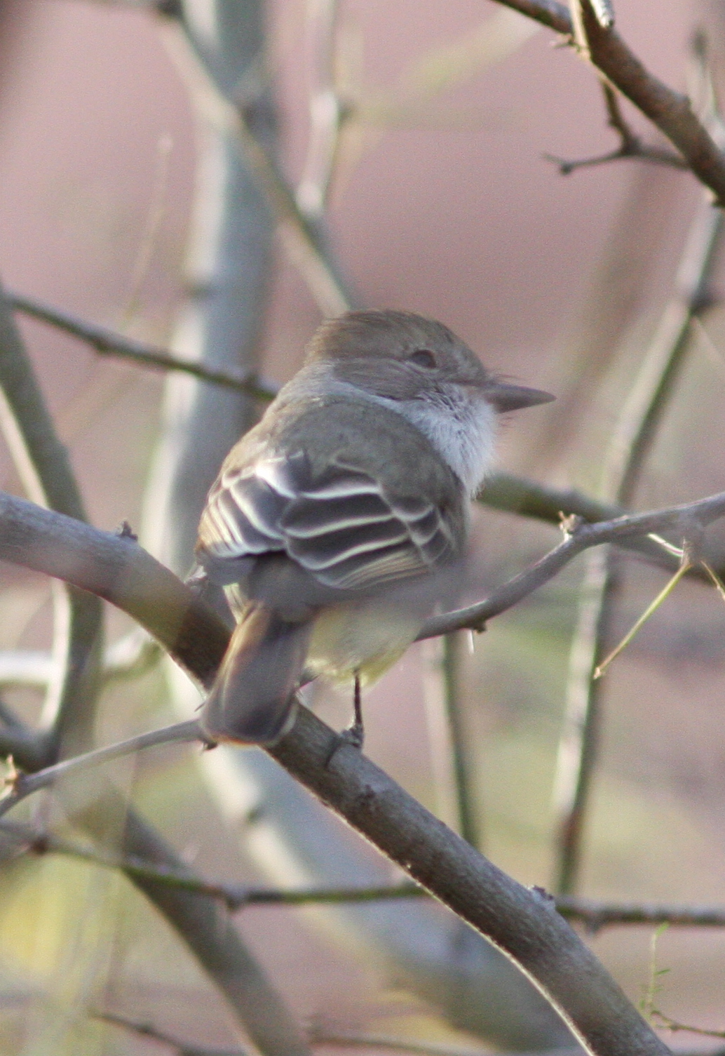
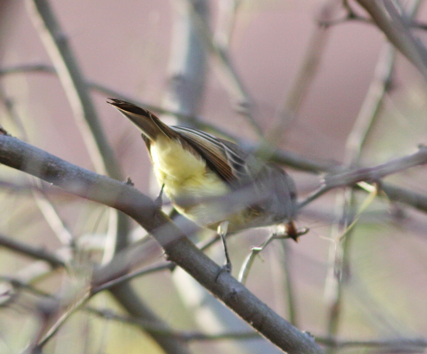
Riparian vegetation, mostly willows, mesquite and tamarisk, runs north to The Refuge golf course. The vegetation is too thick to walk into, so it is very difficult to bird, but it can be rewarding. A surprising variety of birds breeds here.

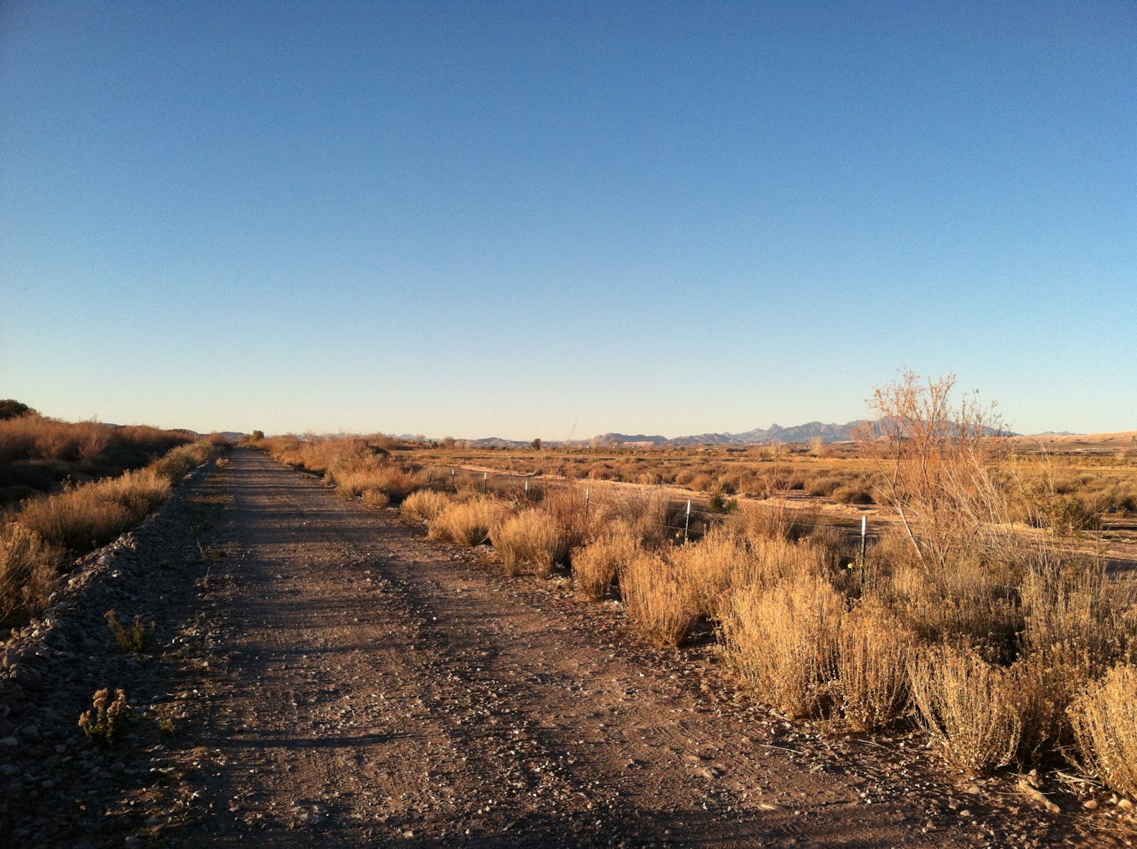
To bird north of Lake Havasu itself, continue on London Bridge Rd. Just before it turns back and meets the highway well north of Lake Havasu City, Crystal Beach/Fathom Dr. cuts west. Follow this to the small community of Crystal Beach. Make a left at the stop sign, and follow Vista Dr. A wide, graded dirt road cuts off to the left down a wash. This leads to Castle Rock Bay. A short hike leads you to a scenic view of Castle Rock and allows you to scan the sheltered bay, which can attract interesting birds. Back on Vista Dr., follow it west until it ends and the road turns north. Park here and walk out onto the hills for a nice overlook of the marshy backwater of the Colorado River just north of Lake Havasu. This is a good spot for dabbling ducks, and to listen for rails in the dense marshes.

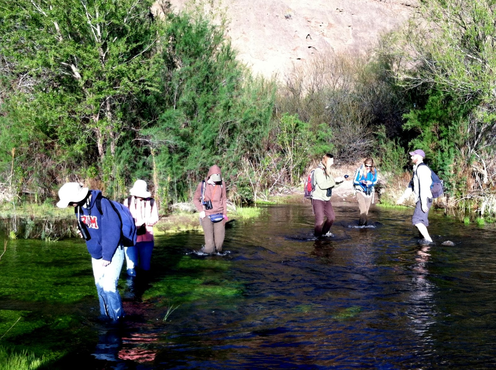
Finally, for a different perspective, this area can be great birding from a kayak. You can’t scope distant loons or jaegers, but you can get up close and personal with gulls, swallows, terns, herons, etc. and you can bird otherwise inaccessible riparian. Public launch points are at Mesquite Bay North and just south of there (a well-marked, brand new launch), and at Castle Rock (but it takes a hike in with the boat).

How I Spent My Spring

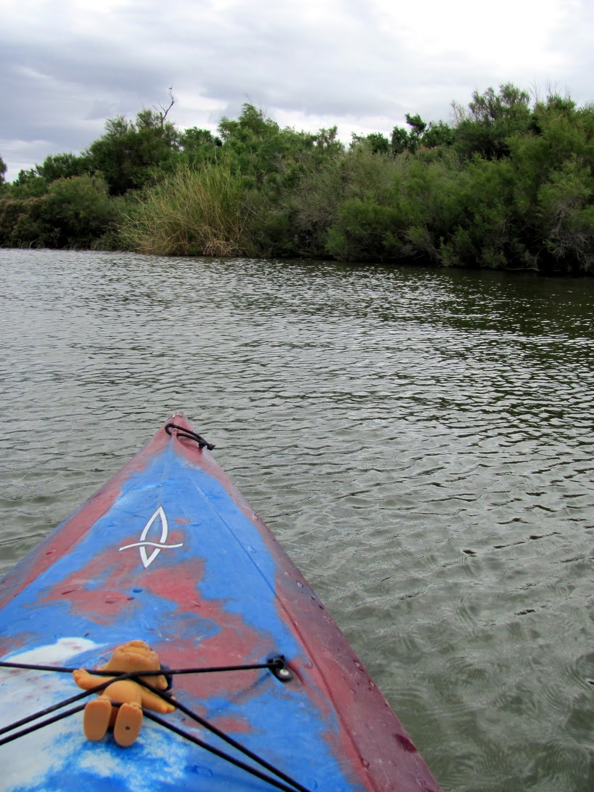
Kayaking just north of Cape Havasu. The troll doll was a treasure found floating in the lake…

I hope this site guide helps folks find the best places to scan Lake Havasu’s north end. So, what’s your favorite place to scan Havasu?

Posted in Birding Locations, Havasu NWR, Lake Havasu, LCRV, Mohave County | Tagged | 2 Comments

Filling eBird Data Gaps

I am a big believer in eBird, its mission and its utility to researchers, observers, and anyone with an interest in birds. One criticism of eBird is that it only goes where birders go; as a result, more data come from places where there are people, and well-known birding areas. For example, the eBird bar chart for La Paz County shows Nutting’s Flycatcher as more common than Curve-billed Thrasher! Lots of people have been to see the second Nutting’s Flycatcher to occur in the county, whereas few birders visit the parts of the county where the thrasher occurs (which is the majority of the county, but not the LCRV).

Curve-billed Thrasher

In western Arizona, common desert species such as Curve-billed Thrasher are often underrepresented in eBird data.

The best way to address these problems is to enter more data! eBird designed a protocol to help birders cover spots more representative of an area, which they call County Birding. I’ve only used this protocol a few times, but it is always interesting!

Another way to improve eBird data is to actively look for data gaps, and fill them. I got the idea from the Central Valley Bird Club to take screenshots of such data gaps to encourage myself as well as others to visit these unbirded areas!

Below are maps of areas close to, and even within, the LCRV that completely lack eBird data. In the upcoming months I’ll post maps for quads that lack data for a particular month, but this should be a good place to start. To explore eBird gaps in this area or anywhere in the world on an interactive map, click here.

Mohave County

Mohave County eBird Gap

This area is at the southern end of Dutch Flat. It looks remote, but it actually has a network of roads running across the north end of the quad. Access is from Yucca, and the habitat is likely a rich mixture of Sonoran and Mohave Desert vegetation.

Mohave County eBird Gap

This large data gap falls mostly in Yavapai County, but the western portion is in Mohave County. The area is likely difficult to access, but it would be a worthwhile adventure and could be very rewarding…

Mohave County eBird Gap

These areas are south of Temple Bar and Pearce Ferry (Lake Mead). They might require some hiking to get to, but could be very interesting. The western one likely has Le Conte’s Thrashers.

Mohave County eBird Gap

The highway cutting through the corner of this quad is 66, and the town of Peach Springs is just barely north of the quad. This would be easy to fill for anyone visiting Grand Canyon West. The area has very rewarding birding.

Mohave County eBird Gap

I’m not sure how accessible this quad would be–it is on the Arizona Strip; note Mount Trumbull to the east. Likely Chukar in those mountains…

Mohave County eBird Gap

This Arizona Strip quad includes the road to Mt. Trumbull (note the mountain itself to the east), so anyone traveling there should make a note to stop in this area!

La Paz County

La Paz County eBird Gap

This is certainly a seldom-visited area, but includes the road to Lincoln Ranch (a private ranch with no access, unless you can find someone to ask permission). It passes through some interesting desert, with red sand dunes and typical desert birds such as Gilded Flicker and Curve-billed Thrasher.

Coconino County

Coconino County eBird Gap

North end of a huge gap in data for Coconino County.

Coconino County eBird Gap

South end of same huge data gap. The southwesternmost tip of this gap is probably in Yavapai County. Most of this area is probably readily accessible.

Clark County

Clark County eBird Gap

Part Nevada and part Arizona, this area includes the north end of Lake Mohave, and starts just south of where Arizona’s first Ivory Gull was found. A highway runs to the river on the Nevada side on the north section of this quad.

Clark County eBird Gap

It seems that every time David and I are traveling this highway, we’re on a hurry to get somewhere. This should be an easy gap to fill, whether for Clark County Nevada or San Bernardino County California.

San Bernardino County

San Bernardino County eBird Gap

This one’s a mystery to me. Probably some interesting mountains in there, and maybe some stray desert birds…

Riverside County

Riverside County eBird Gap

This could be an interesting one–north of I-10, between Blythe and Desert Center.

Riverside County eBird Gap

A large data gap between Blythe and the Salton Sea (some in Imperial County).

Yuma County

Yuma County eBird Gap

Most of Kofa National Wildlife Refuge is a data gap! This includes both Yuma (south) and La Paz (north).

Yuma County eBird Gap

This is the one data gap I don’t think I can recommend going to. The US-Mexico Border south of Yuma probably isn’t the safest of birding locations.

With that in mind, go eBirding, wherever you may be!

Posted in Arizona Strip, Birding Locations, eBird, Imperial County, La Paz County, Mohave County, Nevada, Riverside County, San Bernardino County, Yuma County | 12 Comments

Recording Black-tailed Gnatcatchers

An exciting event for me occurred this past week, when I received my first real microphone, a Sennheiser ME66 shotgun mic. More on that later, but needless to say, I had to get outside to take it for a spin at the first opportunity!

This afternoon, I took advantage of the perfect weather and headed out to my very favorite local spot, Cape Havasu. After giving the lake a scan, I headed down into the desert to find something that was making noise. I was teased by briefly calling Marsh Wrens, a distant Song Sparrow. It was amazingly quiet. A Phainopepla peered out from its favorite mesquite, called once, then went silent. Before long, though, I heard the scratchy notes of a singing Black-tailed Gnatcatcher.

Some argue that the song of a Black-tailed Gnatcatcher doesn’t deserve the designation of a “song”, since it’s not pretty, but I’m sure it does as much for a lady gnatcatcher as the fluting of a Wood Thrush does for a thrush.

Black-tailed Gnatcatcher

The Black-tailed Gnatcatcher is a tiny, often common, but always adorable desert bird (Photo credit: J. N. Stuart)

Anyway, I approached the singer, who was buried in a mesquite, and recorded as he babbled, interspersing the typical “ch-ch-ch-ch-ch” song with scolding call notes and ticking, Verdin-like calls. I’ve been interested in this type of complex song in Black-tailed Gnatcatchers for a while. Its function is not well understood (at least as of the writing of the Birds of North America account). Listen below, but be aware that my fancy new mic was not able to erase the traffic on the nearby road, and I’m a beginner!

(All these recordings are also on Xeno-Canto, but WordPress is lame about allowing iframes in that they don’t.)

Before long he lapsed into the typical “ch-ch-ch-ch-ch” song.

He soon moved off, but I noted his neighbor had been singing a bit as well. I scooted down to say hello, and found him acrobatically flycatching (gnatcatching?) in the arrowweed and mesquite, throwing in a song here and there. The first bird continued to sing, and you can just hear him in the background.

The calling bird in the background seemed to be this bird’s mate. We’ll get to her in a minute. Just for fun, I threw together a couple of spectrograms (using Raven) to compare the typical songs of the two males. (To learn how to read spectrograms, I highly recommend reading this!)

Spectrograms comparing the songs of two neighbor Black-tailed Gnatcatchers

Spectrograms comparing the songs of two neighbor Black-tailed Gnatcatchers

Sound 1 and Sound 2, the top two windows in the screenshot above, are of different songs given by the first male. The bottom two songs (Sound 3) are the second male. Note that the first male sang longer individual notes spaced closer together. Of course I can’t draw any conclusions from listening to these birds for just a few minutes and looking at a few songs, but it does raise some interesting questions and hypotheses. Why was the first bird singing a more hurried song? Each of the songs above is different; how variable is a gnatcatcher’s song?

As I mentioned above, the second male communicated continuously with a nearby bird that I believe was his mate. The first male was unattended, as far as I could tell. Maybe there is some difference in the songs of unmated birds. Maybe his complex song is an advertisement meant for the ladies, as the second bird didn’t sing a complex song, and I hear the plain “ch-ch-ch-ch-ch” song much more often. I’ll be keeping an ear out for this in the future!

Apparently done with singing for the time being, the second male began calling back and forth with his presumed lady-friend.

She then flew in to meet him, and one of the birds (or both?) began giving this unusual call as they foraged together.

One of my favorite aspects of recording birds is that it gets me to slow down and spend a little more time watching and listening. Just 15 minutes with these gnatcatchers taught me a little but raised a lot of questions! I have a lot to learn about vocalizations, their functions, recording and interpreting them. It has been a great learning experience so far!

Black-tailed Gnatcatcher

Breeding male Black-tailed Gnatcatcher (Photo credit: Wikipedia)

Posted in Havasu NWR, LCRV, Sound Recordings, Species Profiles | Tagged , , | Leave a comment

Christmas Birding Trip: Bill Williams to Yuma

This post is a bit belated, but December 15 was my first Christmas Bird Count of the season, the Yuma/Martinez Lake count.  Centered on Imperial Dam, the count circle is equal parts Yuma County, AZ and Imperial County, AZ.  Since Yuma is a good three hour drive, I thought it might be wise to camp down there so I could be fresh for bird counting first thing in the morning!  Naturally, that meant a day of birding my way south.

My first stop was a brief one at the Bill Williams Delta, where our first winter storm of the season had brought overcast skies and drizzle. I was hoping to see the recently reported Long-tailed Duck, but it continued to elude me.  I left before long without seeing much of interest.  A quick stop at Parker Oasis was similarly quiet.  I buzzed through the northern Parker Valley, stopping briefly to watch dancing Sandhill Cranes, check out the continuing Harlan’s Hawk, and count a field full of Killdeer.

Cranes in the Parker Valley
Flocks of hundreds of Killdeer can sometimes be seen in the Parker Valley in winter

Flipping to the California side, my next stop was Palo Verde Diversion Dam.  The wind was blowing so hard I didn’t think I’d be able to bird outside of the car, but a quick scan with binoculars produced a Black Scoter on the water.  A review species in Arizona and a good bird in Riverside County, especially on the Colorado River, I had to figure out a way to get my scope on the bird without being blown into the lake myself.  I repositioned the car so that it would block the wind, which worked out nicely, and I was able to get good looks and some terrible photos of this rarity.

The Loch Ness Scoter

Unfortunately it didn’t move to the Arizona side, but it did fulfill the Prophecy of Three.  David and I have noticed that Black Scoters in Arizona occur in threes.  Either they turn up in a flock of three, or three separate individuals are found in an area in a season.  This is Black Scoter #3 for the LCRV this winter.

My next stop on my way south was Cibola NWR.  I had hoped to check a few spots, but strong winds kept me out of landbirding spots like CVCA and Nature Trail.  It seemed like a good idea to just start with the Goose Loop nature drive and see what was out on the fields.

Before long, I came to a field of recently cut corn, covered in Sandhill Cranes and Canada Geese.  I pulled over here and started counting: 1000 Sandhill Cranes (including one banded bird I was able to get a resight on) as well as several hundred Canada Geese.  I sat in the car, scanned the flock, took photos and sound recordings.

Cranes and geese under moody skies
Sandhill Cranes and Canada Geese at Cibola NWR

I got a few recordings of the foraging flocks.  At first the soundscape was dominated by the lovely rattling crane calls and honking of incoming geese.

Soon, as the sun began to sink, more flocks of geese started to join the throng.  Then Mallards came in.  Since I happened to be running a BirdLog checklist, I counted every flock as it came in and BirdLog added it to the totals.  By the time I left an hour later, I had counted about 800 Canada Geese and 2,285 Mallards, along with 110 American Wigeon and 30 Northern Pintails mixed in with the Mallards.  You can view the eBird checklist here.

It was a sea of green heads once these guys joined in

Just before I left, I took another sound recording.  In this one, Canada Geese are a much more significant part of the soundscape, and the quacking of Mallards is audible in the background.  A faint buzzing noise is the cumulative sound of 800 Canada Geese making soft calls while foraging.

That was all the birding I could fit in for the day, so from there I went straight to Imperial Dam and headed to Ferguson Road, which took me to the shore of Ferguson Lake.  There I found the perfect campsite by the lake, where I sat with a beer under dark skies (no stars, all clouds), did a one-species eBird checklist (American Coots in the dark), and contemplated the day.

I woke well before dawn the next morning to start the CBC with a bit of owling.  Although I couldn’t get any Western Screech-Owls or Common Poorwills to call, I did count four countercalling Great Horned Owls.  I stood over the marsh at the south end of the lake as the light started to bleed onto the eastern horizon and noted several Least Bitterns and a few Soras calling. As the sky grew lighter, more birds started chiming in: Marsh Wrens, Song Sparrows, a few Common Yellowthroats. A chupping Hermit Thrush and a few chattering Ruby-crowned Kinglets.

A hike up the nearby wash was surprisingly birdy.  One of the first birds I heard was an Ash-throated Flycatcher, a very uncommon wintering bird in the area.  It turned out to be a good day for them, and over the course of the day I recorded nine of these critters. Some of the other notable birds among the flocks in the wash were two Green-tailed Towhees and a Bewick’s Wren.

The rest of the morning was spent scanning Ferguson Lake between intermittent bouts of drizzle.  Despite fair numbers of birds like Western and Clark’s Grebes, Double-crested Cormorants, and American Wigeon, I wasn’t able to turn up anything unusual on the water.

Ferguson Lake in the rain

After the afternoon lunch at Phil Swing Park with the rest of the bird counters, I spent some time wandering around desert washes, then headed toward Bard to look for rarities. During this time I realized I wasn’t finding any sparrows!  In areas where I’ve previously seen hundreds of sparrows in winter, I was seeing one or two White-crowned Sparrows at best. No Black-throated Sparrows, and only a handful of Savannah. The habitat seemed grassy enough, so I’m at a loss to explain the absence of sparrows and other grass-eating birds.

One of the highlights of my afternoon, a chilled tarantula

As the sun started to drop, I buzzed over to Betty’s Kitchen to look for the previously reported Thick-billed Kingbird, which would be a Yuma County bird.  Before long I heard a call I didn’t recognize, like a big squeaky Lesser Goldfinch.  I tracked it down, and sure enough, it was the kingbird! It posed for photos and great looks before moving further into the cottonwoods. I walked around the restoration area, tromping through the mud while trying to pick out different species at this incredibly birdy spot.  Not a bad end to a nice day of birding!

My first Yuma County Thick-billed Kingbird. Success!
Posted in Christmas Bird Counts, Cibola NWR, Imperial County, La Paz County, LCRV, Sound Recordings, Trip reports, Vagrants, Yuma County | 4 Comments

Area megas: Ivory Gull and Common Crane!

It’s been a wild week for the Colorado River below the Grand Canyon.

Two days ago (January 16), the news came in that an Ivory Gull had been photographed along the Colorado River somewhere near Willow Beach, but it had a broken wing and the report was a few weeks old.  I held out hope that it might be loafing at Willow Beach eating fish scraps, but in fact it was several miles below Willow Beach, on a small (likely ephemeral) sand bar, and it was photographed December 30–nothing encouraging about its continued survival or any likelihood of ever refinding it.

Still, this is an amazing first state record if accepted by the ABC! It’s so fortunate that the observers, who I gather were not birders, thought to photograph the bird and send them to Andrew Core. Check out the stunning photos here!

Three days ago (January 15), Norman Parrish visited Overton WMA near the north end of the Overton Arm of Lake Mead and photographed a Common Crane! Carl Lundblad got the word out, and it was seen two days later by Rick Fridell, who posted early that it was indeed a Common Crane and still present. David and I debated for about 30 seconds before deciding to go for it! The drive only took about three and a half hours one way, completely reasonable for a lifer for both of us and first NV state record if accepted by the NBRC.

Often in birding we spend a lot of time looking at dull-but-exciting birds like Nutting’s Flycatchers. The Common Crane combined local rarity with a high degree of sexiness, so much so that we watched it for about an hour and a half and only left because we realized it was getting late and we still had to drive three and a half hours home.

Common Crane
One of David’s shots of this beautiful MEGA

After seeing the bird, we stopped to get gas and celebratory hot chocolate and I mentioned the bird to the attendant inside.  She was excited about it, and immediately said she’d take her son out to see it, since he loves birds and it sounded interesting. Cool!

Overton WMA, where we stood and watched the cranes feed

Unfortunately there was a bit of a damper on the experience. When we arrived, a photographer was on the field, walking toward the cranes. The birds were clearly agitated, but she continued moving forward, slowly, in increments. Once it became clear that she was pushing the birds beyond reason, I started calling for her to back off, but she didn’t hear me. Finally, she did hear David, and quickly turned and started walking back. At that point, though, she was about 20 meters from the birds, and the sudden movement caused them to flush. There was no reason for her to get that close to the birds. I don’t quote the ABA Code of Ethics often, but it is worth a read once in a while.

This should not happen–and take note that this was taken with a 300mm lens (David’s photo)

Fortunately, at least, the birds did not go far, just a few fields away. More information about this bird is here. Many thanks to Norman Parrish for finding the bird, to Carl Lundblad for getting the word out and nudging us to go, and to Rick Fridell for confirming that it was present Friday morning!

Posted in LCRV, Mohave County, Nevada, Vagrants | 2 Comments

2012 AZFO Meeting Summary

This fall, Arizona Field Ornithologists held their sixth annual meeting right here in Lake Havasu City.  The meeting was a great success, honoring Gale Monson with talks memorializing him and his work, discussion of the lower Colorado River Valley where he spent many years, and recognition of past and present recipients of AZFO’s Gale Monson Research Grants.  Two days of field trips resulted in an array of unusual sightings.

Read all about the meeting and field trips here!

Posted in AZFO, Events | Leave a comment

CBC Season

It’s CBC season again!  A time of year when birders organize their efforts and agree to spend a day counting every bird in some small corner of the world, then celebrate together at a greasy local restaurant.  I missed the CBCs entirely last year, but this year I’m glad to be participating in at least two, the Yuma/Martinez Lake count and the South End of the Salton Sea.  I’m all about Imperial County, CA in my CBCs.  My December plans are up in the air, so who knows, maybe there will be more for me…

If you’re not sure about the CBC schedule this year, have a look at Arizona counts or California counts.

Have you seen eBird’s recommendations for entering your CBC data into eBird?  Read about it here!

Posted in Christmas Bird Counts | Leave a comment

Birding Planet Ranch Road

With the recent return of the Nutting’s Flycatcher, the Bill Williams River National Wildlife Refuge and Planet Ranch Road in particular are once again getting attention from the birding world.

Map of the western portion of the refuge

On the map above, note the location of the visitor center, a good place to stop in for information.  It’s also a good place to scan the Bill Williams Delta, also known as the Bill Williams Arm of Lake Havasu.  Just down the road east of the headquarters, marked in both directions by brown binoculars signs, is the entrance to Planet Ranch Road.

Sonoran desert and cottonwood/willow/mesquite riparian come together on the Bill Williams River.  This photo was taken just after the gate on Planet Ranch Rd.

Some caveats.  Note that asking a GPS to point you to Planet Ranch Road is not likely to be useful–I’ve heard stories of people turning up in random locations in Parker, and also being pointed to the other end of Planet Ranch Road, a long drive through the desert to a section of the river that is privately owned and not accessible.  The road once ran all the way from Lake Havasu to Planet Ranch, but was washed out in floods several years ago.  Many maps still show it as it was, but it now ends in a gate at the red triangle shown on the map above.

A person walking along the edge of the forest anywhere along Planet Ranch Road is likely to encounter flagging, some of which marks trails entering the forest.  I can’t stress enough the importance of staying off these trails.  Researchers create and use them for a variety of projects on the refuge.  The flagging comes in many colors depending on the project, year, and type of trail.  The trails crisscross and backtrack, some lead into ponds or river channels, and many are disused and being reclaimed by the forest.  Sometimes the flagging just ends.  Navigating these trails requires a knowledge of the flagging systems, a detailed and updated map, and a good handheld GPS unit and compass (not to mention a willingness to crouch, squeeze, climb, bellycrawl, wade, and be scratched up).  Recently, hikers entered the trail system at Mosquito Flats, and eventually became hopelessly lost.  They managed to find a spot with cell reception and called the Sheriff’s department.  The Sheriff’s department flagged their way along the trails, got lost, but eventually (miraculously) found the hikers on the other side of the river, dehydrated but otherwise okay.  Don’t try to hike the trails.

There’s a trail in there somewhere

Sorry for the doom and gloom, but I had to get that out of the way.  So, what is the best way to bird Planet Ranch Road?  The road winds through desert hills, cutting through interesting rock formations and running by washes and canyons.  All of this makes for great exploring, and the dense mesquite edge of the riparian interface can always be good birding.  In my opinion, the best place to bird along the road is Mosquito Flats.  Of course, this happens to be where the Nutting’s Flycatcher is.  This is the only place where the riparian abuts the road, and the mesquite edge even crosses the road.  Birds to be found here regularly include species of cottonwood/willow riparian, mesquite bosques, and Sonoran desert.  Rarities that have been found here include Northern Parula, Black-and-white Warbler, Hutton’s Vireo, Painted Bunting, Gray Vireo, Winter Wren, and Broad-billed Hummingbird.

Birding along the road, you may run across a binoculars sign underneath a double power pole, indicating a nature trail.  More than once I’ve overheard people saying “Hey, this isn’t a trail!”  It is just a short trail that cuts through the thick mesquite and reaches into the forest, where it ends at one of those research trails I mentioned.  Still, even though it is short, it’s worth checking out.

Check out this short jaunt into the forest

So, how about a hike?  I mentioned that the road ends in a gate, but the track continues for miles, ending around the Cougar Point area.  Park at the gate, make sure to pack some water, and explore.  In places the forest is very dense, but in other spots the river channels are very open, and an adventurous hiker can wander to a variety of areas.  Generally, the track is the most direct way to access the best habitat (there are usually tire tracks to follow from ATVs used by the refuge).  Be aware that this hike requires a chilly wade from about December through May, when the river is flowing.

The end of the road
Biologists wading in the river

After a little more than a mile, the road crosses the river and forks.  The left fork runs through some very nice riparian habitat and passes through the old Kohen Ranch.  There isn’t much left of the ranch except for overgrown Bermuda grass fields being invaded by mesquite.  The refuge is working on mesquite restoration in the area, and the resulting brushy mesquite bosque is wonderful habitat for sparrows in the winter.  If you can find the right fork running alongside the river, it passes into more open habitat with some spectacular scenery.  It ends after another mile or so around Cougar Point.

The river crossing just before Kohen Ranch
Bermuda grass fields at Kohen Ranch
Scenery between Kohen Ranch and Cougar Point

What season is best to bird the area?  I recommend late April or early May, when many of the breeders have returned but spring migrants are common, sometimes in large numbers.  Summer can be great birding, with a good variety of breeding species, some of which are amazingly abundant (especially Song Sparrow, Yellow Warbler, and Yellow-breasted Chat).  Black Rails and Elf Owls are some of the more sought-after breeders.  Black Rails will call at night and, sometimes, all day.  Listen for them at Mosquito Flats.  Elf Owls are common in the area–go out on a spring night and keep an ear out, and you will be sure to hear them.  Just remember that they are at the edge of their range here, so please don’t disturb them or play tapes.  Remember that summers are hot in the desert, so it’s best to be out early and back to the car by 10-11.  Fall is more subdued than spring, but can carry surprises of its own, such as the Northern Saw-Whet Owl found at Kohen Ranch this fall.  Winter is more hit-or-miss, with some stretches seemingly birdless until you happen upon a flock, which will typically include many Yellow-rumped Warblers and Ruby-crowned Kinglets.  No matter which time of year you visit, be sure to bring plenty of water.  Allow plenty of time for exploration and enjoy this beautiful and unique area!

Posted in Bill Williams, Birding Locations, La Paz County, LCRV | 2 Comments

ANOTHER Lesser Black-backed Gull

November 30th, after a lovely day rediscovering the now-returned Nutting’s Flycatcher, hiking in the Bill Williams, and finding my La Paz County Winter Wren, I thought I had used up all my birding karma for a little while.  Still, when I pulled into the refuge headquarters to scan the Bill Williams Delta, a not insignificant part of me was hoping that the Lesser Black-backed Gull would show up (click the link for more on LBBG identification).  So while I was sitting in the car starting a BirdLog checklist and I happened to put my binoculars on a brown gull that looked awfully white-rumped, I wasted no time grabbing camera and scope, jumping out of the car and setting up to scan.  I quickly got the scope on a brown gull, but was disappointed to see just another California Gull.  Used to disappointment after three solid days doing nothing but looking for that LBBG, I sighed and scanned on.  Then immediately got on another brown gull, this one with a white rump and white-based tail with a contrasting black band.  The Lesser Black-backed Gull!!

Long wings, masked appearance and white tail with black band.

To say that I was excited to see this bird would be something of an understatement.  Not that it wasn’t fun birding around Havasu for three days and finding some other rarities and all, but I kind of ran myself ragged looking for that bird in Lake Havasu City.  I chased and missed the first state record, as well, a bird near Phoenix in 2006.  So after snapping some photos, I laughed and danced a jig and I’m sure some refuge visitors wondered what was going on with the lunatic with the scope and camera.

Fishing with Ring-billed Gulls

Soon, David had arrived from Havasu.  The bird had flown to nearby Havasu Springs, so we drove over and found it loafing on a beach.  David, being the real photographer between us, had taken control of his camera and got some much better shots.  It was he who first wondered whether it might be a different bird.  I had noticed that it seemed much whiter than in John’s photos, but I didn’t think much of it.  Now much closer to the bird, I checked it out in the scope, and sure enough, it was messier-looking than John’s bird, without those nice clean edgings on the mantle feathers.  It was a single feather, though, that finally convinced us that it was a different bird.  In the flight shots above, note an obvious missing primary on the left wing.  One of David’s photos shows that this feather isn’t missing altogether, but is actually growing in, and it’s more than four days along.

Narrower tertial edgings and messier scapulars and wing coverts than the Lake Havasu City bird
Better photo showing how white the plumage is.  Photo by David Vander Pluym
White plumage streaked with brown, masked face.  Photo by David Vander Pluym
The magical photo showing the primary growing in!  Photo by David Vander Pluym

Exciting times here on the river!

Posted in Bill Williams, Identification, La Paz County, LCRV, Mohave County, Vagrants | Leave a comment

The Nutting’s Flycatcher is back!

Just after 8:00 this morning, after about 15 minutes of birding, I was walking down the road at Mosquito Flats in Bill Williams River NWR, planning out my post to the listserv about the continued absence of the Nutting’s Flycatcher.  Of course it was at that moment that I heard that singular “WHEEP!”  I didn’t think I had missed it so much, but that sound brought a huge smile to my face. It’s back!

The flycatcher is behaving much the same way it did last year.  It called infrequently and was difficult to pin down, but once I located it foraging next to the road, it gave me some great looks.  Photos and sound recordings below from this morning.

“Miss me?”
Eating a mantid.  Check out the cinnamon secondaries!
Short, stout bill, bright yellow belly, cinnamon secondaries, and a greenish back are all good field marks.
The Bill Williams River NWR is about halfway between Parker and Lake Havasu City.  You can get to the flycatcher from Highway 95.  Take Planet Ranch Rd east from the highway (between the refuge headquarters and the Bill Williams bridge) and drive to mile marker 2, where cliffs rise on the east side of the road and riparian vegetation borders the left side.  Also check out the map.
Posted in Bill Williams, Identification, La Paz County, LCRV, Sound Recordings, Vagrants | 3 Comments